ISRO's 'Smart Boy' Rocket To Launch Key 'Swadeshi' GPS Satellite Today. Why It Matters
ISRO is launching NVS-03 aboard the GSLV rocket tonight from Sriharikota. The mission aims to fix a critical gap in NavIC, India's homegrown GPS network that has been unable to pinpoint standalone locations since March.
Verdict: misleading.
Without four working satellites, India cannot calculate standalone coordinates, leaving civilian phones, trains, and defence units dependent on foreign GPS.
Short answer: India’s homegrown GPS system, NavIC, cannot currently tell you where you are standing on its own. Since March 2026, the network has been down to only three working satellites in orbit. Because navigation physics strictly requires signals from at least four satellites to pinpoint a location, NavIC can currently only broadcast accurate time. To find your actual position on a map, Indian phones still quietly rely on American GPS or Russian Glonass. Tonight at 11:51 PM, ISRO launches the NVS-03 satellite aboard its heavy-lift GSLV rocket from Sriharikota. This mission provides the missing fourth satellite needed to restore true swadeshi navigation.
1. Why India’s homegrown GPS cannot tell you where you are right now
Social media posts often boast that India has fully replaced American GPS with its own domestic system. The reality on the ground is quite different.
Right now, if you turn off American GPS on your smartphone, NavIC cannot guide you home.
The reason comes down to basic school geometry and the speed of light:
- Signals travel at light speed: Satellites beam radio signals down to Earth at roughly 300,000 kilometres every second. That means a signal travels 300 metres in just one-millionth of a second.
- Your phone has a cheap clock: Satellites carry multimillion-dollar atomic clocks that stay accurate down to billionths of a second. Your smartphone runs on an inexpensive quartz watch crystal that drifts out of sync constantly.
- Why three satellites are not enough: When your phone catches a signal from one satellite, it knows it is somewhere on a giant sphere around that spacecraft. A second satellite narrows your position down to where two spheres cross. A third satellite narrows your location to two distinct points on Earth.
- The fourth satellite fixes the error: If your phone clock is fast or slow by just one microsecond, your location on the map jumps by 300 metres. A fourth satellite acts as a referee. It gives your device an extra mathematical measurement to correct its internal clock and lock your true position.
Union Minister Jitendra Singh laid out these exact numbers in a written reply to the Lok Sabha in July 2026. Singh explained that standalone positioning requires a minimum of four operational satellites. Because only three satellites currently work, NavIC can provide timing services, but cannot give users their standalone coordinates.
2. From ‘Naughty Boy’ to ‘Smart Boy’: The rocket carrying India’s hopes
Tonight’s launch relies on the Geosynchronous Satellite Launch Vehicle, known as GSLV-F18.
For years, space scientists and journalists gave the GSLV an affectionate but nervous nickname: the “Naughty Boy” of ISRO. During its early development, the rocket suffered several heartbreaking failures. Its complex cryogenic upper stage, which burns liquid hydrogen and liquid oxygen at freezing temperatures, repeatedly ran into technical snags.
Times have changed. Over recent missions, ISRO engineers mastered the cryogenic engine. The launcher delivered satellite after satellite into orbit with pinpoint precision.
Having proven its reliability, observers and space enthusiasts now proudly call the rocket the “Smart Boy” of the Indian fleet.
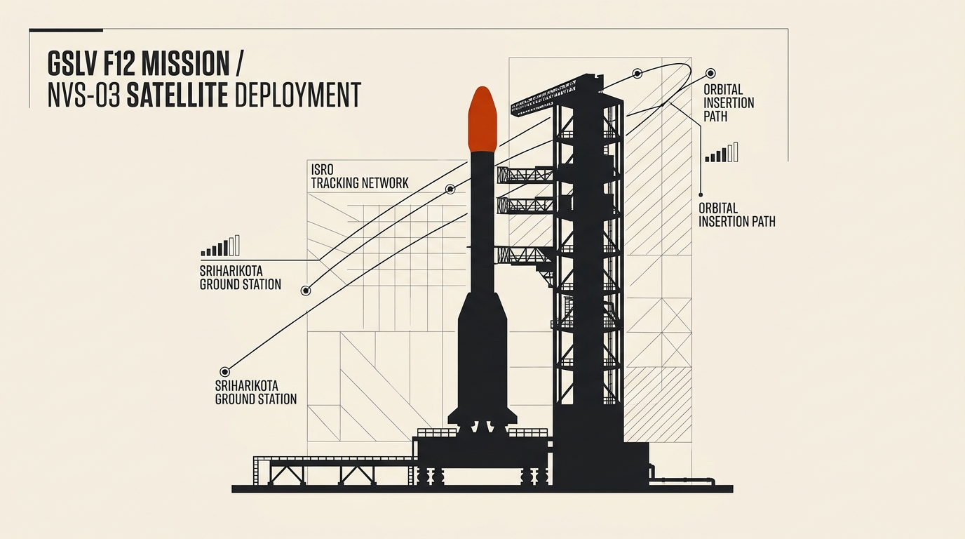
Tonight, the 51-metre-tall rocket stands on the Second Launch Pad at Satish Dhawan Space Centre in Sriharikota. Its job is straightforward but demanding:
- Lift off into the night sky: At 11:51 PM, the rocket will ignite its solid core and four liquid strap-on boosters, generating massive thrust to clear the launch tower.
- Reach transfer orbit: The three-stage rocket will carry the 2,200-kilogram NVS-03 satellite to an altitude between 170 kilometres and nearly 37,000 kilometres above Earth.
- Circularize into position: After separating from the cryogenic stage, the satellite must fire its own liquid engine to climb into a permanent circular orbit 36,000 kilometres above the equator.
3. The rocky road behind NavIC: Clocks, stuck fairings, and silent valves
Why did India want its own satellite navigation network in the first place?
The answer traces back to the 1999 Kargil conflict. When the Indian military needed vital GPS data over the mountains, access to foreign signals was restricted. The central government recognized that relying entirely on another nation for navigation created serious national vulnerabilities during a crisis.
In May 2006, the government formally approved the Indian Regional Navigation Satellite System, later named NavIC by Prime Minister Narendra Modi in 2016.
The plan called for seven active satellites. Three would hover in fixed spots 36,000 kilometres above the equator. Four others would trace an inclined figure-eight path to keep constant watch over the subcontinent and waters extending 1,500 kilometres beyond its borders.
Yet keeping seven satellites alive in the harsh environment of space proved extraordinarily difficult:
- Failing atomic clocks: On the very first satellite, IRNSS-1A, all three Swiss-made rubidium atomic clocks stopped working by 2016. Parliamentary inquiries revealed that an overheated electrical capacitor in the power supply caused the failure.
- A stuck heat shield: In August 2017, ISRO launched IRNSS-1H to replace the broken satellite. During ascent, the rocket fairing failed to open. The satellite remained trapped inside the rocket tip like a coin inside a sealed jar and burned up upon re-entry.
- Audit criticisms: While replacement satellite IRNSS-1I finally made it to orbit in 2018, the Comptroller and Auditor General reported that project delays and contract disputes set the system back by nearly seven years.
- The January 2025 valve glitch: Last year, ISRO launched NVS-02 to replenish the fleet. The satellite reached space, but a tiny electrical signal failed to open a single-use pyro valve. Without fuel reaching its engine, the spacecraft could not raise its orbit and was lost for navigation duties.
- Aging hardware: Of the three working satellites left, IRNSS-1B was launched in April 2014 with a planned 10-year lifespan. It is now operating in its 13th year and could fail at any moment.
4. What changes tonight if NVS-03 succeeds
If tonight’s launch goes smoothly, India takes a major step toward real navigation independence.
The NVS-03 spacecraft carries several key upgrades designed to fix past mistakes:
- Restoring the magic number four: Placing NVS-03 into service gives NavIC four active satellites. That immediately restores independent 3D position fixes across the country.
- An Indian-made atomic clock: Alongside imported backup units, NVS-03 carries a space-qualified rubidium atomic clock built by the Space Applications Centre in Ahmedabad.
- Upgraded pyro valve circuits: Engineers modified the internal wiring and added backup firing lines so the valve issue that crippled NVS-02 cannot repeat.
- The new civilian L1 signal: Older NavIC satellites only beamed signals on the L5 and S frequency bands. NVS-03 broadcasts on the common L1 band (1575.42 MHz). This frequency allows ordinary smartwatches, fitness bands, and budget smartphones to use NavIC without expensive custom chips.
- Backbone for vital transport: When fully functional, NavIC signals support real-time tracking for over 10,400 railway locomotives, 40,000 coastal fishing vessels, and cyclone early-warning networks.
- National self-reliance: Sovereign navigation protects emergency services, cargo logistics, and border defense from foreign signal denial, mirroring India’s parallel investments in commercial satellite spectrum battles and satellite broadband deployments.
ISRO is not stopping here. Two more satellites, NVS-04 and NVS-05, are currently being assembled for launch next year. In the future, planners hope to launch Medium Earth Orbit satellites to expand NavIC into a global system.
Tonight, however, the mission has one urgent goal: getting that critical fourth satellite safely into the sky.
Sources to check yourself
- Lok Sabha Secretariat (Unstarred Question No. 1290): Read government disclosures regarding active NavIC satellite counts and operational constraints.
- Indian Space Research Organisation (GSLV-F18 Mission): Check vehicle parameters, launch timelines, and satellite specifications.
- Comptroller and Auditor General of India (Report No. 8 of 2018): Review audit findings on satellite manufacturing schedules and procurement delays.
- Space Applications Centre (SAC-ISRO): Examine technical specifications for the indigenously developed rubidium atomic frequency clock.
Frequently asked questions
Q: Can I use NavIC on my smartphone right now? A: Yes, but only in combination with foreign networks. Modern phone chipsets blend NavIC data with US GPS or European Galileo satellites to calculate a location. NavIC cannot calculate your coordinates completely on its own until a fourth satellite enters service.
Q: Why does satellite navigation need four satellites instead of three? A: Three satellites narrow down your latitude, longitude, and height. However, because phone clocks are slightly inaccurate quartz timers, a fourth satellite is needed to calculate and cancel out the clock error.
Q: Why was the GSLV called the ‘Naughty Boy’? A: Early versions of the GSLV suffered multiple launch failures due to tricky cryogenic engine issues. After engineers resolved those problems and achieved a steady run of successful flights, observers started calling it the “Smart Boy”.
Q: What happened to the NVS-02 satellite launched in 2025? A: An electrical signal failed to open a small valve connecting fuel to the satellite engine. Because the engine could not fire, the spacecraft could not raise itself into a circular operational orbit.
Reader discussion
Conversation for this story opens with memberships. Until then: found an error? Report it — we correct visibly.